At the crossroads between the Upper Richmond Road and Sheen Lane, there's a milestone from 1751, next to the 20th Century war memorial - two landmarks that are self-consciously 'historical' at an intersection of the modern world.
A leaflet from the excellent Barnes and Mortlake Historical Society pointed us to some more subtle links to the past, no further from home.

Our first stop, down Sheen Lane towards the station, was the left turn into St Leonards Road. If you'd asked me to find you a barn in East Sheen, I would have been stumped. But there is one, large as life, which our leaflet told us may have been left over from the market gardening business that once dominated the area.

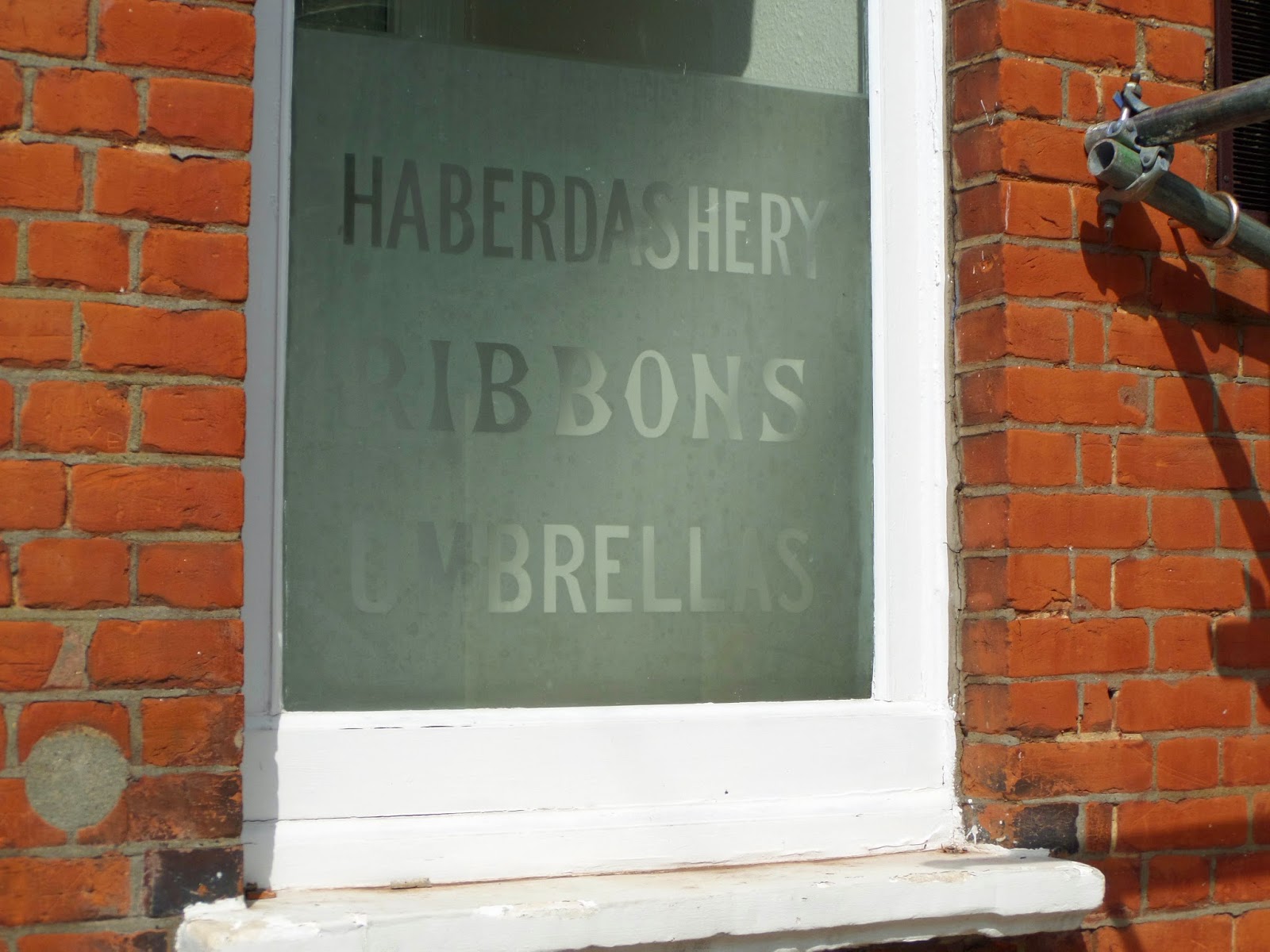
More definite is the history of the building on the north corner of Sheen Lane and St Leonards Road. It has a turret, an appropriately showy feature of the department store it once was. Rayner Canham opened for business about 1910 and only closed in the 1960s, when it was known as Simmonds. There's a flavour of the place in one of the ground floor windows, which still advertises its wares:
Continuing away from Sheen Lane, the leaflet directed us to St Leonards Court, a 1930s apartment development. At it centre is a raised lawn with a small circular building on its edge. This turns out to be the entrance to an air raid shelter which still exists beneath the lawn. It's apparently one of the best examples still around, and is being preserved. It may be that one day, parties of schoolchildren will be touring its four large rooms - two for men, two for women.

If you're wondering whether an air raid shelter was really needed, another piece of work by the Historical Society proves emphatically that it was: a map of where Second World War bombs fell in the area shows that nobody was more than a street away from having one land on them. Thankfully, most of the red dots on the map also report "no casualties", although the one at Mortlake Brewery records "160 quarters of malt lost".
One connection with the war not recorded in the leaflet, is the blue plaque on another apartment block in Sheen Lane: it shows where the BBC broadcaster Richard Dimbleby lived in the couple of years before the outbreak of war. I wonder if during his busy, dangerous years reporting the war, he wished he was back in East Sheen.

A more subtle connection with the war is the unmarked house a couple of streets over, in Richmond Park Road, which provided a temporary home for a double agent, sending messages to Germany to fool its military commanders into thinking the D-Day landings would be at Calais rather than Normandy. Four bombs had landed in that part of Richmond Park Road in the autumn of 1940. By the time the Pole known as Agent Brutus was at work, East Sheen was relatively safe from bombs, though no doubt their effect was still visible in most streets.
The leaflet from Barnes and Mortlake Historical Society is 'Sheen Vale: A circular walk starting at Sheen Lane Centre, Sheen Lane, SW14'. It includes plenty of other points of interest in addition to those mentioned above.
Hey Charles,
ReplyDeleteThanks for writing about this.
They have demolished this barn over the past week (towards end of April 2018).
I spoke to the site manager (a very nice chap).
He says a historian who does walks of London visited the site and that this was originally used for potato storage.
The building next to it on Sheen Lane (which was a Threshers that went under) has been used for various businesses... not just a haberdashery but possibly also a card printing shop (which claims to have been based on "Richmond Rd"?) according to a sign on the outside of the building.
It is a shame that it has been demolished as it provided some character to the area.
If you have any further photos it would be great to post them up!
Adam